“Rare map of North America first published by Paolo Forlani in 1565, the first separately published map of North America”
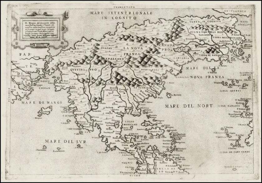
This is the first map of North America and the first map to show the Straits of Anian.
Paolo Forlani’s rare and finely engraved map of North America is one of the most significant early maps of America. It is the earliest printed map devoted solely to North America, the first to portray that landmass as a separate continent and the first to show the so-called Strait of Anian separating America from Asia at the approximate location of the Bering Strait.”
Spanish, Italian, Indigenous, Portuguese, and Asian translators, take a look and help us in the comments with your best translations of these place names. See a familiar word from your non-English vocabulary?! GREAT
COMMENT BELOW, And don’t forget to ADD the name of your language, home Country, and any other thoughts relating the map to something familiar to YOU. Let’s explore the world, here’s the view from MY ‘here’ before there was a camera capable of capturing the North American Continent- from outer space… pretty cool, huh?!

